


The River That Became a Garden
There is a particular kind of urban planning that begins not with a vision but with a wound. The Turia Gardens are that kind.
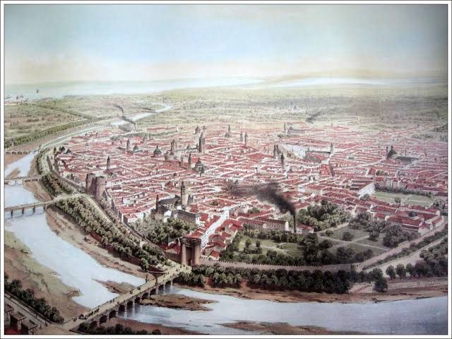
On October 14, 1957, the river that had run through the center of the city for centuries overflowed with a violence no one had planned for. Nearly three quarters of the city was inundated, and over sixty people lost their lives. It was the sort of disaster that reorders a city's relationship to its own geography. The response, at first, was purely engineering: divert the river. By 1958 the decision had been made to reroute the Turia away from the historic center and convert the abandoned riverbed into an urban highway — the reflexive twentieth-century answer to almost any empty urban corridor. Give it to the cars.
What happened next is the part worth studying.

A Slogan Against a Highway
Citizens objected. Not with committees and white papers, but with a slogan that has outlived every planning document from the era: "El llit del Túria és nostre i el volem verd" — the Turia riverbed is ours, and we want it green. It was a demand made in the declining years of the Franco dictatorship and pressed through into the democratic opening of the 1970s, and it worked. By the end of that decade the city had approved legislation to turn the dry riverbed into a park instead of a road, commissioning Ricardo Bofill to draft a master plan in 1982.
I find this sequence more instructive than the park itself: catastrophe, bureaucratic reflex toward infrastructure for machines, and then a sustained public refusal that reversed the plan entirely. Most cities don't get that second act. Valencia did, largely because the demand was popular, plainly worded, and repeated for a decade without dilution.
Nine Kilometers, Eighteen Zones, No Single Architect
What makes the Turia Gardens interesting as a planning object is that Bofill's 1982 master plan didn't try to impose one unified design across the entire corridor — it divided the riverbed into eighteen zones, each assigned to a different designer or institution. Bofill himself took the stretch near the Palau de la Música, working with orange and palm trees and drawing on the Roman idea of urban space as a meeting ground. Another team, Vetges Tú–Mediterrania, handled the section running toward Nuevo Centro, with sports facilities and fountains, while the regional Department of Agriculture planted thousands of pines to create what's called the "Urban Forest." Later came the Gulliver playground, where children scale the limbs of a reclining giant, and eventually Santiago Calatrava's City of Arts and Sciences at the eastern end, where the park meets the sea.
The result is not a coherent aesthetic. It is a coherent principle — that a nine-kilometer scar through a city can hold multiple publics, multiple uses, and multiple design languages, and still read as a single civic gesture. Today the park is the most visited in Spain, drawing more than three million people a year.
The Park That Remembered Why It Existed
The most consequential thing about the Turia Gardens may be that its origin as a flood-prevention measure was never fully forgotten in the design. The engineered riverbed and its diversion channels were built to withstand far greater volumes of water than the 1957 flood produced — and that design choice was tested rather than theoretical. In late October 2024, during the catastrophic DANA storm, nearly a year's worth of rain fell on the region in eight hours. The diversion channel neared capacity, but the historic center did not flood; the Turia Gardens functioned as intended, absorbing the surge and shielding the city's infrastructure, even as unprotected areas beyond the system's reach suffered badly.
Plaques marking the 1957 flood's high-water levels are still scattered through the city — a park that is also, quietly, a memorial and a warning.

What the Model Actually Teaches
Planning literature likes to extract "success factors" from cases like this, and in Turia's instance they hold up reasonably well: citizen empowerment through sustained public participation, phased long-term planning that allowed the design to adapt over decades, and a multifunctional program combining recreation, culture, and sports that connects rather than divides neighborhoods. The same sources are honest about the difficulty of exporting the model: sustaining funding and coordinating among many municipal departments across decades is genuinely hard, and Valencia had the advantage of a single, undeniable catalyst — a flood no one could argue with.
A Central Park, in Reverse
For a New Yorker, the comparison is unavoidable: the Turia Gardens are Valencia's Central Park — the one great democratic green space against which the city measures itself, the place where all of its publics converge. But the genealogy runs in reverse. Central Park was willed into existence before the city grew around it; the Turia was wrested back from a disaster, and from a plan that would have made it something else entirely.

And here the New York parallel darkens. The highway Franco's planners envisioned in the dry riverbed would likely have resembled what Robert Moses did with the FDR Drive along the East River: a limited-access artery threading traffic straight into the heart of the city. Had it been built, it would have funneled the automobile into Valencia's historic center — the same center that today breathes precisely because that traffic was never invited in, its flows pushed outward and dispersed. Valencia, in effect, got the fight New York had — Moses and his expressways against Jane Jacobs and her neighborhoods — and resolved it the other way, with a slogan in Valencian doing the work that Jacobs' pickets did in Manhattan. One city buried a river under a park; the other never let the highway reach the riverbed at all.
What stays with me, though, isn't the policy takeaway. It's the shape of the argument itself: a city nearly destroyed by water, offered a highway as consolation, and choosing instead — loudly, for years — a garden. Infrastructure as apology. Infrastructure as memory. It is, I think, the closest thing urban planning has to literature: a form that has to hold both function and grief at once, and mostly doesn't manage it. Here, for once, it did.

Comments